|

By Brian Jamieson
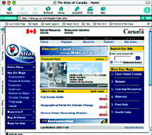
www.atlas.gc.ca
 You'd
expect a web site that flags queries such as "What's the highest
mountain in Canada?" and "What's the longest river?" to
have those answers neatly tied up and available as a prelude to information
on mountain ranges and river systems. You'd
expect a web site that flags queries such as "What's the highest
mountain in Canada?" and "What's the longest river?" to
have those answers neatly tied up and available as a prelude to information
on mountain ranges and river systems.
Not so with the Natural Resources Canada-created Atlas of Canada site.
In the case of the former, for example, users have to scan through a screens-long
list of mountains categorized by province or territory before discovering
Mount Logan in the Yukon. That said, the site offers a wealth of maps
and useful, authoritative, current and accessible geographic information.
There are more than 200 interactive maps available within a click-historical,
reference and economic maps, maps on the environment and people and society,
maps on climate change, fresh water and health. Visitors can see everything
from the distribution patterns (market share) of large cars and small
vans, and ratios of family doctors to Canadian residents to formations
and ages of rocks, and the striking points of tornadoes and other major
hazards.
Want to know where in Canada Waldo is? There are more than 40,000 place
and physical feature names to search in the database. Want to throw a
pop quiz including questions from categories such as the Land, the People,
the Ecology and the Economy? Easy. Click on the selections and the questions
shoot back.
Site organizers envision having the most interesting, dynamic and comprehensive
collection of maps and related information about Canada available anywhere
on the Internet, along with effective and intuitive tools for users to
access them. Since 1906, there have been five printed editions of the
Atlas of Canada. The online version is number six and reflects a repository
of knowledge that far exceeds the previously published tables and charts
and includes data analysis that goes far beyond the maps themselves.
One caution though: some of the explanations are too technical and difficult
for the uninitiated and may best be geared to senior secondary school
students. Obvious applications are to social studies, particularly geography
classes. But there's enough cross-curricular information to easily fuel
classroom work and discussion in environmental studies, history, economics,
languages, biology and mathematics (statistics).
The site also has useful links to Natural Resources Canada, Statistics
Canada and Canada's SchoolNet sites. www.atlas.gc.ca
is easily traversed and contains a helpful glossary. Definitely a worthwhile
starting point when you're discussing projected effects of accumulated
greenhouse gases on global temperatures in the year 2050.
|